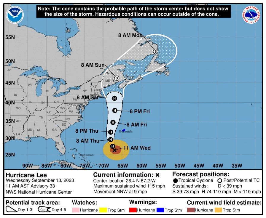
COURT HOUSE – The Cape May County Office of Emergency Management (OEM) has issued key messages for our region on the potential impacts of Hurricane Lee as it moves north along the Atlantic coast.
Dangerous surf and life-threatening rip currents are already present along the coast and are expected to intensify for the remainder of the week and begin to subside on Sunday.
The ocean waves will become increasingly hazardous for small craft. Waves could exceed 10 feet by Thursday or Friday.
Minor coastal flooding and beach erosion will become a concern as the system makes its closest approach late Friday into Saturday.
Winds over the ocean and adjacent near-shore regions could reach gale force levels (gusts near 40 miles per hour) late Friday into Saturday. Gale warnings may need to be issued.
Lee’s track could still change and produce further impact in the region. These could include stronger winds and rain.
The public can track the storm at www.nhc.noaa.gov. The county OEM will provide another briefing Thursday at 4 p.m. The full OEM briefing is available at https://capemaycountynj.gov/alertcenter.


