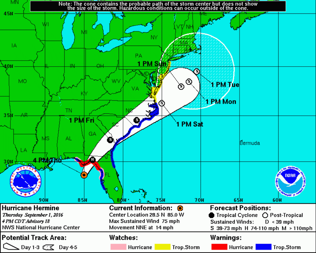
COURT HOUSE – National Weather Service (NWS) issued a tropical storm watch for our area beginning Sept. 1 at 5 p.m.
According to NWS’ latest briefing as of 5 p.m. Sept. 1, “Hermine has strengthened into a hurricane, but is still expected to weaken to a tropical storm shortly after it makes landfall in Florida tonight. Not much change in the forecast track of the storm. There remains quite a bit of uncertainty with the track beyond tomorrow. Please continue to monitor this system as it moves north this weekend.”
Rip currents, tidal flooding, strong winds, and heavy rain are likely.
Expected hazards, according to NWS:
Rip Currents: High Confidence. A moderate to high risk for the formation of dangerous rip currents will continue through at least Labor Day, and may continue into Tuesday. As is always the case, people at the beach should enter the water only if lifeguards are present. Most rip current deaths occur on beaches when and where no lifeguards are on duty. Beach erosion is also possible.
Tidal Flooding: High Confidence. Minor tidal flooding is likely beginning with the Saturday evening high tide cycle and continuing through the Sunday night high tide cycle, possibly continuing into Monday. Moderate tidal flooding is possible with the Sunday high tide cycles. Given multiple rounds of tidal flooding, water in the back bays will have a hard time draining between tidal cycles which could lead to prolonged flooding in these locations.
Strong Winds: Moderate confidence. There is a chance of tropical storm force winds (sustained winds of 39 mph or greater) for much of the region. The highest chance is along the Delaware Beaches and the Southern New Jersey Shore. Even with an offshore track, gusts of 30 to 35 mph are expected along the coast.
Heavy rain: Moderate Confidence. There is expected to be a sharp cutoff in the heavy rain dependent on the track of Hermine (a track further off the coast lessens the threat for heavy rain). At this point, the highest risk of heavy rain is along the coast and coastal plains. The primary flooding hazard will be street and flash flooding. The recent dry weather will lessen but not eliminate the risk of river and stream flooding.
According to the briefing, “The rip current risk is expected to persist through at least Monday (Labor Day). Winds are expected to increase around mid-day Saturday, then continue through the holiday weekend. Rain is expected to begin on Saturday, then continue heavy at times through Sunday.”
View the latest briefing here.