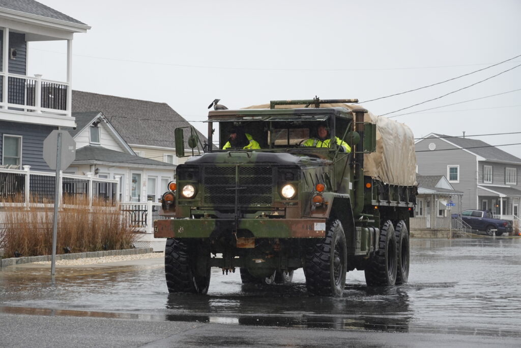
Upper Township Business Administrator James Van Zlike was standing in 10 inches of water, he said, when he spoke to the Herald about flooding in the township’s Strathmere section.
“There’s a three-block area where there is no dune. The beach is at the same level as the street,” Van Zlike said when contacted via cellphone.
A Nor’easter battered Cape May County Sunday, Oct. 12, through Monday, Oct. 13. Although inland towns were relatively unscathed, residents in Cape May County’s island communities dealt with the worst flooding since Hurricane Erin in August.
The effects of the flooding were not as severe as anticipated due to relatively low winds, a lack of large waves near shore and low rainfall. It rained 1.75 inches or less across Saturday, Sunday and Monday.
Still, lots of locals were whipped into a tizzy on Facebook as AI-generated images of flooding were passed off as real. One post, of water all the way up to the Wildwoods sign on Rio Grande Avenue, got particular traction.
Regarding damage in Strathmere, Van Zlike on Monday said that he, Mayor Curtis Corson and the township engineer were on the scene surveying significant erosion in Strathmere. According to Van Zlike, the dune at Seacliff and Seaview avenues was completely gone.
He said the limestone rock core of the dune was completely exposed, and between there and Winthrop and Williams avenues there were about three blocks of dune that had disappeared.
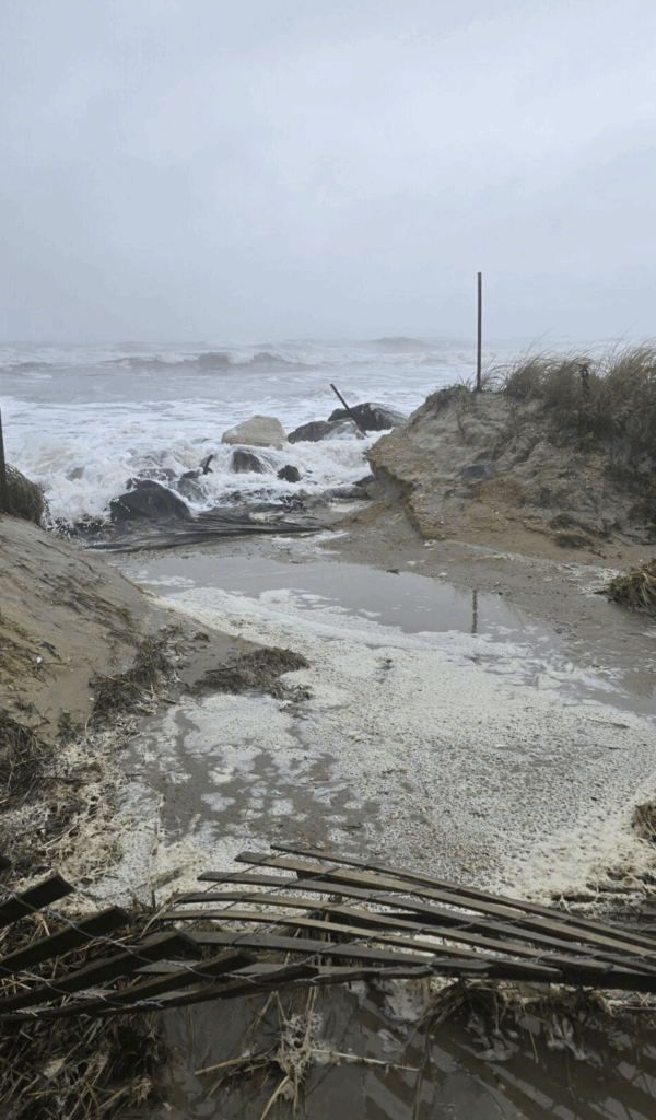
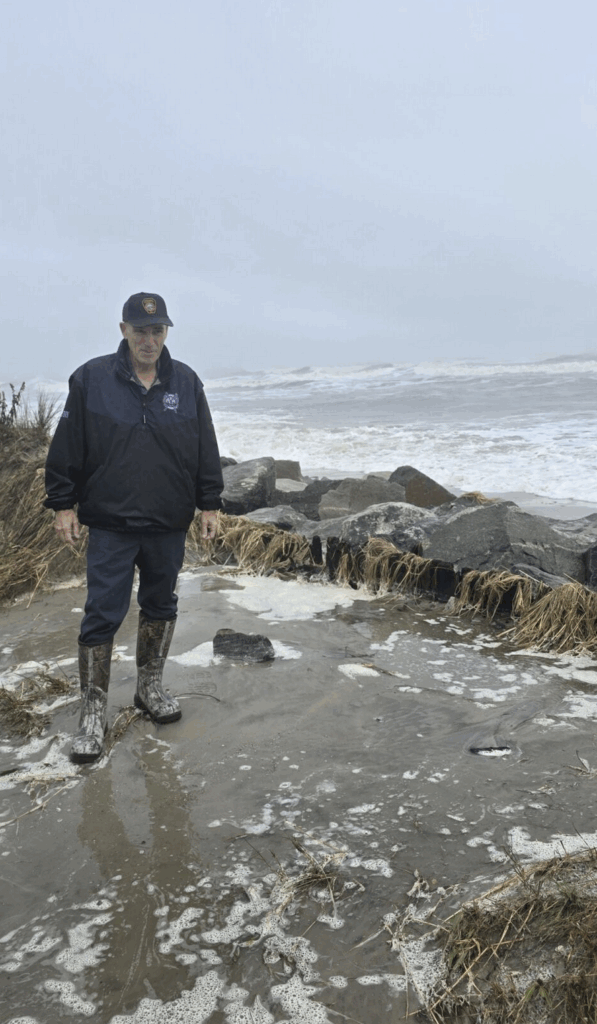
Van Zlike said some roadways were barricaded because they were covered in sand, temporary plastic fencing and other debris. He said the good news was that no houses on the west side experienced water intrusion, mainly because most of them had been raised.
All the beach damage occurred on the north end of the island, with other areas being relatively untouched.
P.J. Hondros, with Stockton University’s Coastal Research Center, said the storm was the kind of “average nasty Nor’easter we get every year or two.”
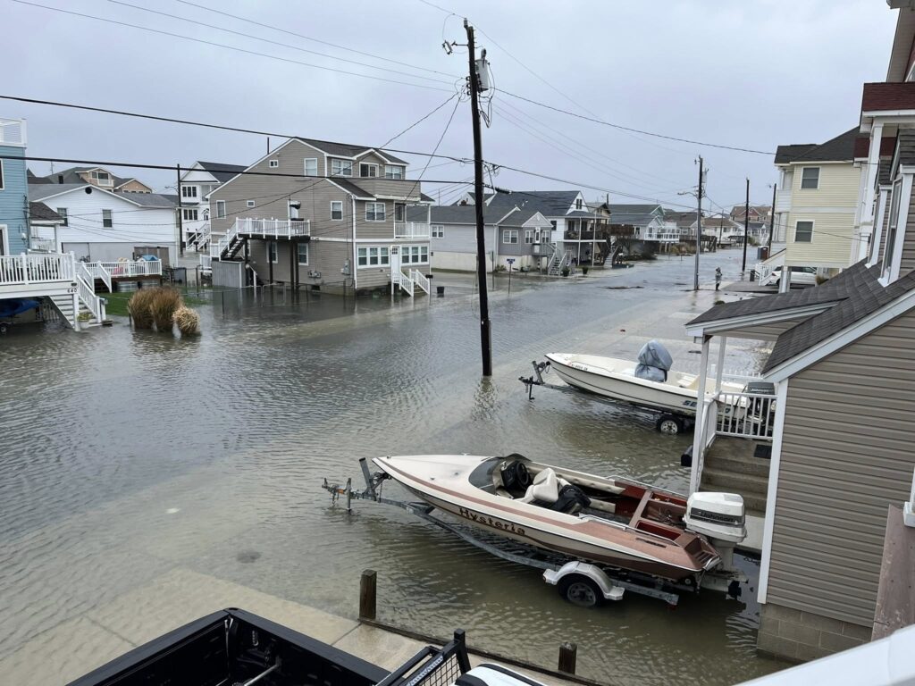
For folks in North Wildwood, that meant knee-high water on avenues like Delaware and New York during the worst of the storm.
In Wildwood Crest, that meant bayside streets, especially Park Boulevard, had about a foot of standing water during both days of the storm.
“The predictions were ugly prior to the first high tide on Sunday, but fortunately those predictions didn’t match the actual high tide,” Hondros said. “The actuals came in about a half-foot under the worst case.”
His comments were echoed by municipal leaders, who said their towns saw flooding, but it wasn’t as bad as they had expected.
Katherine Custer, Saa Isle City’s Director of Community Services, said that she and the public works director drove up and down the entire beach on Tuesday, Oct. 14, after the storm to survey damage.
“We fared extremely well,” she said. “About the same as Hurricane Erin during high tide.” She said that the dunes are fully intact, but it remains to be seen how much beach was swept away.
Sea Isle City frequently experiences flooding during storm events on the 30th streets between Central and Landis, and mid-island around Central and 46th to 49th Streets.
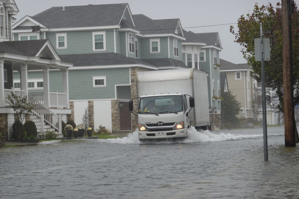
Sea Isle City, like other shore towns, has a big problem with large vehicles driving through flooded streets, sending waves crashing against property. The city had a wide-scale public information campaign to prevent this before and during the storm, with reverse 911 calls to residents, information in the city’s digital newsletter, and a giant digital sign near the entrance to town. “People were a lot better about it,” Custer said.
Jay Gillian, mayor of Ocean City, said in a statement, “We were very fortunate that today’s peak flood level (6.95 feet mean low water) fell well short of what was predicted (7.2 feet to 7.6 feet mean low water).” Gillian said that “deep floodwaters” covered many streets in the city despite the relative lack of rain across the two days.
Still, once the storm ended, it took about four to five hours for the center of the streets to drain and six to seven hours to drain completely at the curb.
The Wildwood Police Department was sending out regular announcements advising people not to drive through flood waters, and to announce the closing and reopening of the George Redding Bridge, depending on the flooding.
Wildwood Mayor Ernie Troiano Jr. said ocean water made its way to the boardwalk, but there was no wave action. He said the water cleared the beach berm and could not make its way back, hence some flooding on the beach. On the other side of the island, he said, it floods where it normally would flood after a storm or very high tide.
“We had some flooding where it normally floods,” the mayor said. “Thank God the winds died out.”
Like other municipal leaders, Troiano said the flooding was less than anticipated. He said that a bigger problem than flooding is people who drive through city streets, creating a wake that impacts houses.
“The biggest problem is the (expletive) that drive down the road throwing wakes,” he said. “We tell people to stay the hell off the streets, they do it anyway.”
Asked if Wildwood had an ordinance, like North Wildwood, prohibiting that kind of driving, Troiano said, “You would think common sense would rule the roost. Don’t they realize it’s saltwater and it’s tearing up their undercarriage?”
Otherwise, he said, there was no significant damage to city property or private property, for the most part. He said he lost a door off an accessory building, a section of fence fell, and an artificial palm tree blew off a deck.
Wildwood Crest Mayor Don Cabrera said the ocean came up to the dune line, but not enough to cause significant erosion. “There was minimal erosion,” he said.
As in Wildwood, the more significant street flooding happened on the west wide of the island, from Rambler Road to Cresse Avenue, during the high tides.
“This is where the current project is still in construction,” he said, listing bulkheads, valves, outfall pipes and raised street ends.
Avalon Administrator Scott Wahl said his town is perhaps more susceptible to the machinations of the Atlantic Ocean, being 3.5 miles out to sea. The area experienced mainly tidal flooding – the worst on Sunday afternoon. Overnight Sunday to Monday, there were no problems, and Monday’s afternoon high tide was lower than Sunday’s.
“The winds turned around and helped keep the flooding moderate,” Wahl said.
He said the borough has been proactive in establishing construction regulations, adding that town officials believe municipalities should be allowed to develop their own resiliency standards. The borough also has a living shoreline project, paid for entirely with a federal grant, that should help make its bay areas more resilient.
Wahl said about four or five years ago the borough put out its flood risk map, which is color-coded, and it lets residents know when they might have to move vehicles or take some other action.
“It helps people make a decision,” he said. He said the borough also puts out announcements advising people to not drive in floodwaters.
Contact the reporter, Chris South, at csouth@cmcherald.com.