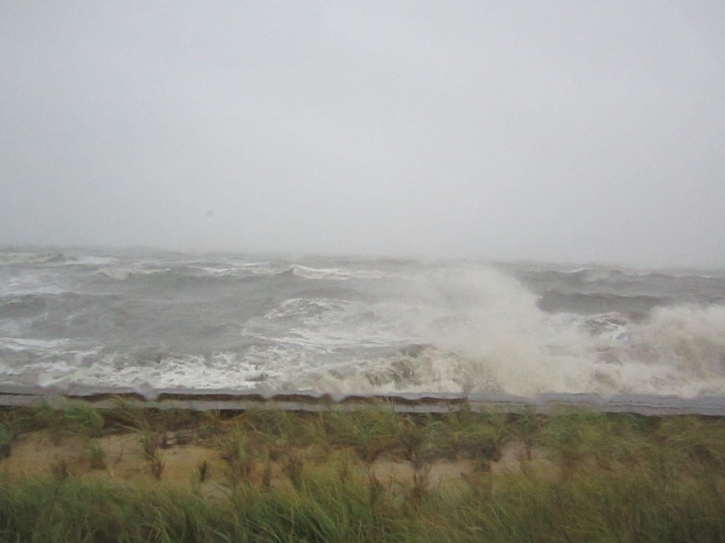
PORT REPUBLIC- Sand dunes made all the difference whether homes were destroyed or saved along the New Jersey coast during Hurricane Sandy.
Stewart C. Farrell, professor of Marine Geology at Stockton College, founder and director of the Coastal Research Center, is the expert beach towns and state and federal governments go to for advice on beach erosion and protection.
He has been assessing the damage from the storm on Long Beach Island for FEMA, the state and the Army Corps of Engineers.
On Long Beach Island, there are multiple municipalities which are segmented between Long Beach Township. Beginning in 2007, the Army Corps of Engineers began constructing a $79 million shore protection project from Barnegat Light to Little Egg Harbor. The project was estimated to cost $79 million for 15 miles of beach nourishment on a stretch from Long Beach Township, south of Barnegat Light Borough to Holgate, said Farrell.
There was an issue related to acquisition of property owner’s easements before the project could begin. Individual property owners owned the dunes in front of their homes and the dry beach to the high tide line, he said.
The Army Corps of Engineers told state and local partners they were responsible for getting property owners to approve easements so they could proceed with the project.
“Many of the owners said we are not giving up any property rights unless we get paid handsomely for it,” said Farrell.
He said no money was available but the beach protection benefited the homeowner.
It turned into a long arduous process. In 2007, the dune renourishment began in Surf City, in Harvey Cedars in 2009 and in Brant Beach in 2011.
“Three communities were completed before Sandy hit,” said Farrell. “All of the island had dunes of varying quality and width and heights in front of all of the properties but obviously some were less effective than others.”
He said the core design called for a design of 22 feet in height with a 25-foot wide top and 5-1 slopes down to the beach on either side. It sat in front of the existing dune, said Farrell.
“Then in front of that they were going to build a 100-foot wide beach at elevation 8 feet and then a slope towards the ocean at a 1 on 20 gradient which would take you another 20 or feet or so to the high tide line,” he said.
The plan was to push the high tide line out to sea by over 200 feet.
In 2009, before work began in Harvey Cedars, about two dozen residents refused to sign easement agreements. Farrell did a public presentation in 3D with the help of the state and borough to the public showing what would happen if there was a 20-year or 50-year storm prior to the dune construction and what would happen in those storms after the project was built. He said the project wasn’t built.
He said some of the homes had about 12-15 feet of dune left from their front doors after a November 2009 Veteran’s Day storm. Farrell told them they would get a “bloody nose” from a 10-year storm, a “tremendous wallop” from a 20-year storm and be wiped out from a 50-year storm.
With the dune in place, a 50-year storm would take about 25 to 30 percent of the dune, he said.
“That got most of them to sign, there were hold outs and Harvey Cedars went ahead and condemned them and took it any way,” he said. “That’s still at the state Supreme Court for file adjudication.”
Farrell said Superior Court granted them a large sum of money. The Supreme Court has not rendered a decision on the Appellate Division upholding a Superior Court decision, he said.
On Nov. 1-2, Farrell was on site surveying 14 sites on Long Beach Island where the project was completed.
“The dune was between one-third and two-thirds still there at elevation 22 (feet),” he said. “No sand in the streets, no house damage, the beach is heavily eroded but that’s fine, it’s pretty easy to pump it back.”
Once a dredge is on site, the coast of beach replenishment is about $2.5 million per mile, said Farrell.
“Those houses are worth $3 million apiece from an 80-foot frontage, so it was definitely a worthwhile investment,” he said.
The project was not done in Holgate, Loveladies, North Beach and to an extent Beach Haven.
Farrell said Holgate was “annihilated,” from Hurricane Sandy with a dune that was “too narrow and too weak” and was swept entirely onto the island and into Barnegat Bay.
Dunes in Atlantic City were 14.5 feet above sea level. Farrell said waves were measured at 14 feet with some trickle of water over the top. The boardwalk was undamaged other than in the inlet area which was scheduled for demolition, he said.
“In Atlantic City, had they lowered the dunes by two feet, they would have had over wash to the point where the cutting would have erased the dunes about a third of the way through the storm, leaving the boardwalk the only defense for the casinos and other businesses, which would have done a number on them because the boardwalk is a hell of a battering ram,” said Farrell.
He noted Cape May had no damage other than Poverty Beach which had six feet of sand in the street. There was no damage from waves in Cape May Point, Avalon, Stone Harbor, Sea Isle City or Upper Township, said Farrell.
He said there was some was some over wash in Sea Isle City. Farrell said it flooded the beach and cut a few notches in the dunes and took away about 150,000 cubic yards of sand offshore.
Stathmere has a 300-foot wide beach which broke the waves.
“They rolled across it and ran up the dunes and stopped,” he said.
Farrell said Strathmere is low and it floods.
He said Ocean City has robust dunes and had no wave damage. The south end, 50th to 59th Street where dunes were low “got blasted” along with erosion at The Gardens, said Farrell.
“I’m going out on a limb in saying the 1992 December nor’easter and Hurricane Sandy were almost the same in Cape May County,” said Farrell.
During the 1992 storm, massive amounts of water were in the streets of Avalon with inlet homes “thoroughly trashed,” he said. Since then, a $20 million seawall has been constructed, said Farrell.
“Avalon has been kind of like the poster child for grooming, developing, currying and defending their dune system and it paid dividends compared to ’92 when water was coming down the street as 3-foot walls,” he said.
Was Farrell surprised by the aftermath of Hurricane Sandy?
“The amount of damage north of the eye was compounded by the extra surge height the storm had plus the spring tide plus the fact that it just was coming straight into the coast,” he said. “I was astounded at the 25-foot high run up on the dunes at Seven President’s Park in Monmouth County.”
Farrell said two houses sitting at an elevation of 32-feet above sea level were destroyed. A fishing pier at Phillips Avenue now rests on top of a bathing pavilion which it crushed.
Farrell bemoaned the fact that a number of owners of homes built on pilings have enclosed their ground floors. He said according to FEMA rules, the ground floor under the first habitable floor should not be enclosed with anything accept latticework and breakaway walls.
Farrell said homeowners have installed concrete floors, 2 X 4’s, sheetrock, insulation, siding, windows and doors on the ground floor. In addition, homeowners have placed washers, dryer, freezers, air conditioning units, water heater and furnaces on the ground floor. He said a lot of them wound up in Barnegat Bay from Long Beach Island.


