AVALON – In August 2017, Stockton University’s Coastal Research Center placed sensors in flood-prone areas of Avalon and Longport as part of a study of nuisance flooding.
The goal was to collect data that could be tied to weather information and tide levels for the development of a better predictive capability, an effort to reduce property damage caused by flooding.
Stockton’s Dr. Stewart Farrell and Matthew Suran went before Avalon Borough Council Aug. 14 to report on the conclusion of the study. Half the study’s cost was funded by the two communities and 50% came from the Atlantic Cape Coastal Coalition.
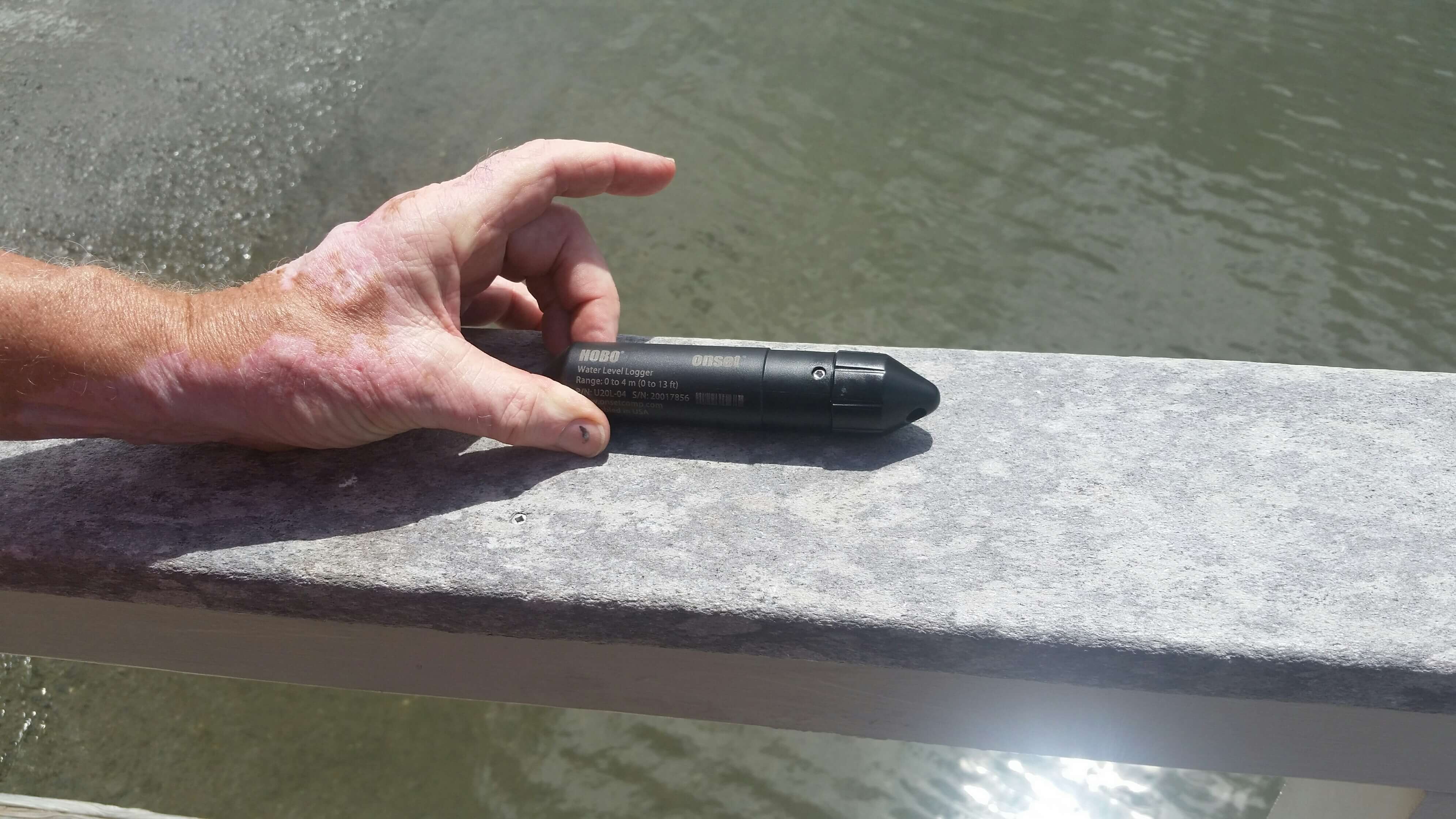
The data was collected by a series of $300 Hobo Sensors, about the size and shape of a fat cigar, positioned throughout the communities in areas known for frequent nuisance flooding. Thirteen of the sensors were located in Avalon.
The sensors recorded pressure levels and timestamped readings continuously. By using weather station data to measure changes in air pressure, the Stockton team was able to subtract air pressure from the readings recorded by the sensors, leaving a reading of water pressure when events put the sensors below water levels.
Information on flood events, flood heights, and duration of flooding could all be teased from the sensor data from each of the 13 stations, providing the research team with a picture of the extent and frequency of nuisance flooding over a period from August 2017 to February 2019.
The study recorded 151 events, measured by sensor location, on 26 total days, 20 of which recorded flooding over the one-foot mark.
The presentation showed how the data could be linked using a picture of flooding on Eighth Street during an April 15, 2018 rain event that started at 4:26 p.m. and ended at 1:07 a.m.
That event occurred when two inches of rainfall coincided with a spring tide. The high tide impeded the stormwater drainage system from releasing water into the bay, reducing the rate of flow from the event, labeled event 59.
With the data linking information from weather stations, sensors, and tidal gauges, the research team hopes to develop a better warning system, based on expected tides and rain, alerting homeowners to take precautions, like removing vehicles from areas likely to flood soon.
The borough has established its weather station. In August 2018, a Davis Vantage Pro weather station was installed on the radio tower adjacent to the public safety building.
The eventual goal of the reach team is to help the borough establish automated, real-time warnings to registered homeowners. Farrell also added that the sensor data, if combined with information from the borough pumping stations, could be used to see the “value added” by stormwater drainage designs.
A full report with detailed data and graphics would be given to borough officials as soon as it is completed.
To contact Vince Conti, email vconti@cmcherald.com.