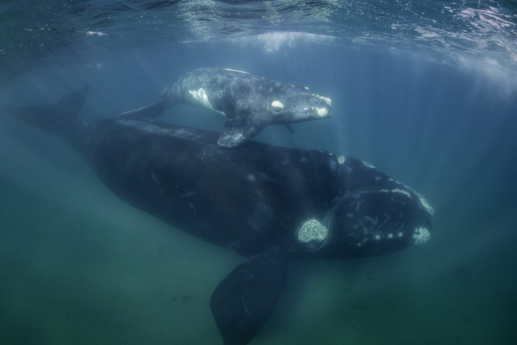
CAPE MAY POINT – Cape May Point Science Center, slated to fully open to the public this coming spring, hopes to help track endangered whales using satellite technology to save them from the deadly fate that met several whales in New Jersey alone in 2023.
Bob Mullock,who is largely responsible for the birth of the new Science Center, hopes that ever-improving satellite tracking devices can be used to track whales. When large boats and whales are tracked in tandem, it should be easier for boats to avoid whale collisions, he said.
AIS (Automatic Identification System) transponders are currently too large to affix to a whale, but recent breakthroughs in satellite tracking technology give Mullock hope that whales can be tracked more accurately than in the past.
Mullock presented his plans to county business people at a monthly Cape May County Chamber of Commerce meeting but spoke with the Herald afterward to provide more details.
“We need to not only figure out why whales die, but to prevent it. We don’t want to be the county that tracks the last right whale,” he said about the North Atlantic right whale, a species killed primarily by rope entanglements or collisions with large boats.
The species’ numbers are currently estimated to be as low as 350; they were fiercely hunted for their high-blubber content to the point of near-extinction.Right whales travel more closely to the surface than other whale species, which, coupled with their low population numbers, make them easier to potentially track, Mullock said.
AIS transponders are currently affixed to all ocean vessels that weigh over 300tonsor are over 65 feet in length. These trackers provide automatic data, via satellite, on a boat’s speed and position, which is reported to the International Maritime Organization. Many of these vessels can be tracked by anybody for free online via MarineTraffic.com
Mullock proposes similar satellite transponders be affixed to right whales, and that the new Science Center be at the forefront of that effort.
“We could actually have part of the institution dedicated to tracking whales using the AIS system that already exists to see where whales are crisscrossing with ships. That isn’t that far out,” he said.
Mullock hopes that whales tracked within the AIS systems could potentially be viewable by ship operators. Again, he stressed that the trackers used to track boats are not animal ready.
“You cannot only prevent ship incidents, but you can see if a whale has spent an inordinate amount of time in one area or is moving unusually slowly. You could send out a drone to look at that whale and see if it is entangled in fishing nets, and then send out a rescue team,” he said.
He is not alone in this idea. Peter Swanson, a prolific maritime writer, wrote about the ways that AIS tracking could help prevent whale deaths more effectively than a National Oceanic and Atmospheric Administration (NOAA)-proposed speed limit off America’s East Coast.
Mullock said that the precise tracking of whale movements via satellite is already happening in a limited capacity. Oregon State University researchers developed a satellite tag that they used to track the depth and location of blue and humpback whales. Researchers with the Italian Ministry of the Environment successfully deployed satellite tags on two fin whales in 2015; their efforts up to that point were met with failure because the tags kept failing. Bullhead whales are being tracked off the Alaskan coast.
Mullock hopes that Cape May County can be a leader in the battle to save whales from colliding with vessels. Although a timeline is unclear, he hopes that the center can partner with Rutgers and NOAA in addition to their already established relationship with the Cape May Whale Watch and Research Center.
The Herald will have more on local whale tracking as it develops.
To contact Collin Hall email chall@cmcherald.com or call (609) 886-8600.


