Get important news and weather developments anytime, anywhere, with Herald mobile alerts. Sign up now.
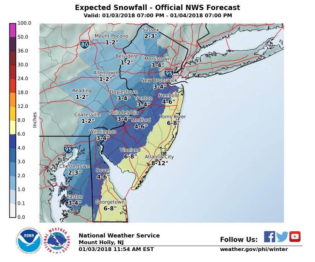
COURT HOUSE – National Weather Service (NWS) has issued a winter storm warning and coastal flood advisory for Cape May County.
The winter storm warning will be in effect from 9 p.m. Jan. 3 until 7 p.m. Jan. 4.
According to NWS, snow accumulations of 8 to 12 inches are expected.
Heavy snow and blowing snow expected. Plan on difficult travel conditions, including during the morning commute on Thursday. Tree branches could fall as well. Winds gusting as high as 45 mph will cause areas of blowing and drifting snow. Scattered power outages could develop Thursday and Friday which would force considerable hardship where heat would not be available.
A winter storm warning for snow and blowing snow means severe winter weather conditions are expected. If you must travel, keep an extra flashlight, food and water in your vehicle in case of an emergency. The latest road conditions for the state you are calling from can be obtained by calling 5 1 1.
The coastal flood advisory will be in effect from 8 a.m. until 2 p.m. Jan. 4.
High tide on the southern New Jersey ocean front occurs around 9:30 a.m. with minor flooding anticipated. High tide on the back bays occurs later than the high tide on the ocean front.
Surge will be half a foot to a foot above astronomical tide, and waves will be 2 to 4 feet.
Localized roadway flooding is expected. Some roads may be closed due to high water. In addition, stagnant flood waters may freeze on road surfaces.
A coastal flood advisory means that minor tidal flooding is expected. Minor tidal flooding often results in some road closures. Usually the most vulnerable roadways will flood.
Do not leave your vehicle at a location that is prone to tidal flooding. Do not drive your vehicle through flood waters. The water may be deeper than you think it is. You will be putting yourself in danger and your vehicle may be damaged, leading to costly repairs.
Visit the Advanced Hydrologic Prediction Service at water.weather.gov/ahps for additional water level and flood impact information for your local tide gauge.
Be sure to continue to monitor NWS’ latest forecasts for updated information at http://www.weather.gov/phi/winter.


