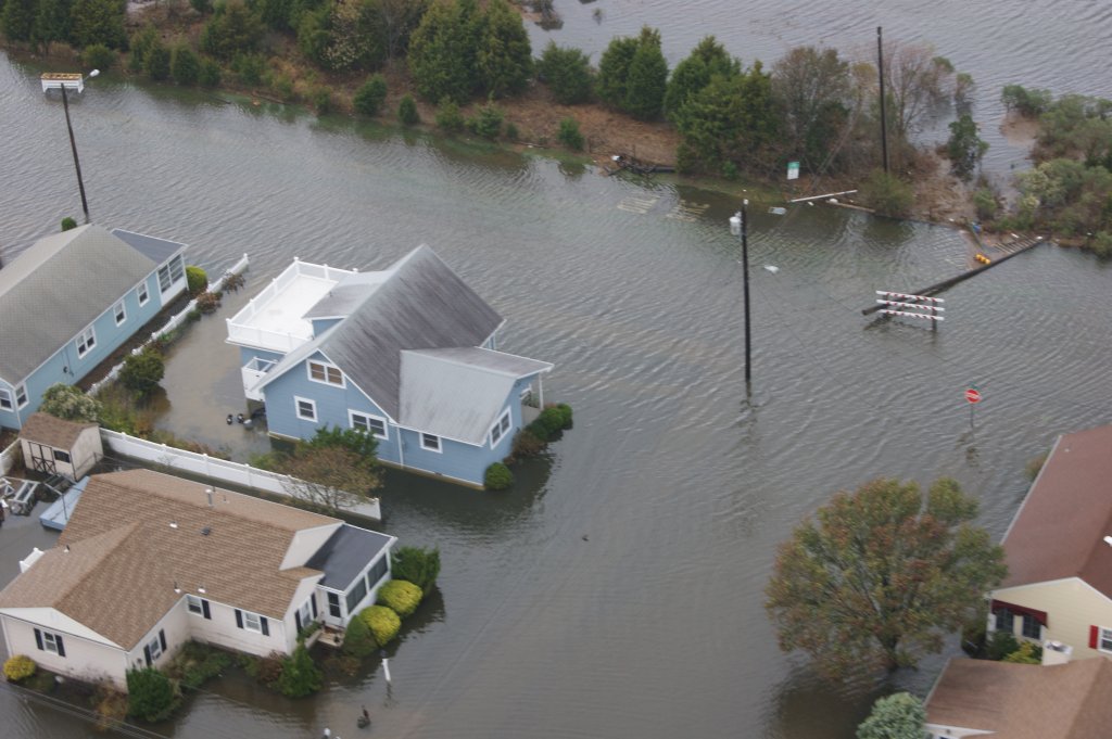
COURT HOUSE – As of Dec. 15, the public will have the ability to review the latest FEMA-produced “advisory base flood elevation maps” for 10 New Jersey counties, among them, Cape May County.
Those newly-revised maps are important to those whose properties sustained damage in Hurricane Sandy. While advisory, the maps show heights above flood level that will aid property owners plan future building or renovations. When they become finalized, in about two years, those maps will play a part in the risk that is calculated for flood insurance premiums paid by homeowners and businesses in flood vulnerable zones.
Effective Dec. 15, interested parties can visit www.region2coastal.com to learn their municipality’s revised flood elevation levels. The maps cover 194 communities in the 10 coastal counties. Those who visit the site should click on the “Sandy” tab to learn how to use the advisory information.
In a Dec. 14 press conference call briefing media representatives of the maps, Ryan Pietramali, risk analysis branch chief, FEMA, and Bill McDonnell, deputy hazard mitigation branch director, FEMA, fielded questions about the maps and new advisory base flood elevations.
Although the maps release seem coincidental to the devastation wrought by Sandy, they were actually in production long before the storm formed over the Atlantic. They will replace maps drawn over two decades ago, and cover some 1,800 miles of New Jersey’s coastal tidal zone.
The maps depict flood hazards which have changed over the past few decades, especially as water heights gradually increased and storms become more severe. The data contained in them shows the “best available data concerning base flood elevation levels,” and reflect updates in benchmarks on existing properties.
It is FEMA officials’ hope that the maps will be used to help the state rebuild better and stronger than before to prepare for future storms.
The maps “reflect a higher hazard than is used now,” said Pietramali. He anticipates that the new flood elevations will be one to five feet higher than the present flood rate maps.
“Individuals must understand the risk profile has gone up,” he added. Individuals should “take this information to make informed decisions.”
Pietramali stressed that the newly-issued maps will not impact flood insurance rates. Still, he noted that the higher a dwelling is the more savings can be expected in flood insurance premiums. FEMA and the state have partnered to advise local governments of the new maps to encourage community engagement to bolster codes so that structures will be less vulnerable to storms.
“It is important that people know their risk,” Pietramali said. He also urged individuals to “work with resources available to them” meaning private as well as governmental sources.
“The Advisory Base Flood Elevation maps are put out to assist individual and communities to recover from Hurricane Sandy,” he added.
McDonnell said the reason the maps were created so “expeditiously” was to assist those counties to rebuild, but were not created as a result of the hurricane. “All we did was extract data we were developing and expedite the product delivery,” he said. It is hoped that “communities and citizens will take ownership” of the information contained in the new maps, he added. Armed with the data, all parties can “take action in a smart and safe way to rebuild,” he continued.
To a reporter’s question why have base flood elevations gone up, and why are they different than 25 years ago, Pietramali replied “We’re not driving the same cars we did, science has changed in the way we understand and we have updated topography this is based upon.”
The new maps will not have an immediate effect on flood insurance premiums. The process will take about two years to move into final maps, which will them be used for community risk ratings.
Is funding available to assist property owners who view the maps and want to consider elevating” asked another reporter. McDonnell replied there are “a couple of programs possible” for such owners, if their property was “substantially damaged,” there is up to $30,000 in funding to assist. There are grants through hazard mitigation to local municipalities which may want to consider a community approach, how to make buildings more resilient, he added.
Why has it been so long since flood maps were revised? Pietramali replied it is “Expensive to update them across the country.” He estimated it takes between three and five years as an average time to update maps.
Cape May County – I’d like to suggest to the Herald that they leverage spout offs draw and replace some of the ads for their paper with a few paid ads that you probably can charge a little extra for. Lots of people…


